Rotterdam City Walking Tour
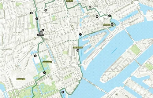
Explore Rotterdam on foot with this free walking route that takes you past water, art and striking architecture. Covering around 7 kilometres, the route starts at Rotterdam Central Station and can be completed in about two hours. Along the way, you’ll get a real sense of the city’s energy, from green parks and modern museums to historic harbours and well-known highlights. It’s an easy and engaging way to get to know Rotterdam for the first time.
Explore Rotterdam at your own pace
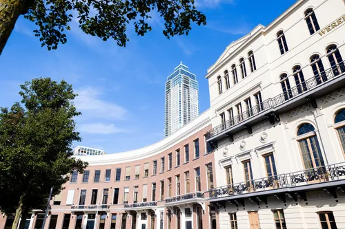
Starting at Rotterdam Central Station, the route leads along the Westersingel, where sculptures line the canal, towards Museumpark. Here, you’ll pass cultural landmarks such as the Depot Boijmans Van Beuningen and the Kunsthal. From there, the walk continues through greener surroundings before opening up to views of the skyline and the river at the Erasmus Bridge.
After crossing the bridge, the route follows the waterfront past Willemsplein and the Wijnhaven, where Rotterdam’s maritime character comes into view. Along the way, you’ll encounter a mix of places, from lively streets like the West-Kruiskade to quieter spots such as the Veerhaven. The route then continues towards the Cube Houses, the Laurenskerk and the Markthal.
From there, you’ll walk through the central shopping district and via Schouwburgplein back towards Rotterdam Central Station. Near the end, you’ll pass the Tramhuis, now a starting point for city walks. All together, the route offers a varied introduction to the many sides of Rotterdam within a relatively short distance.
Free download
Prefer to follow the route at your own pace? You can download the walking route as a free PDF (20 MB), including a clear map, step-by-step directions and 18 highlights along the way.
The guide is also available at Rotterdam Tourist Information and Rotterdam Central Station. Staff there can help with practical tips, information about the Rotterdam City Card and advice to make the most of your visit.
Also available in other languages
City Map Rotterdam
The Official City Map Rotterdam is a handy map of the major sights and must-sees of Rotterdam. This city map is available for free at the Rotterdam Tourist Information offices.
